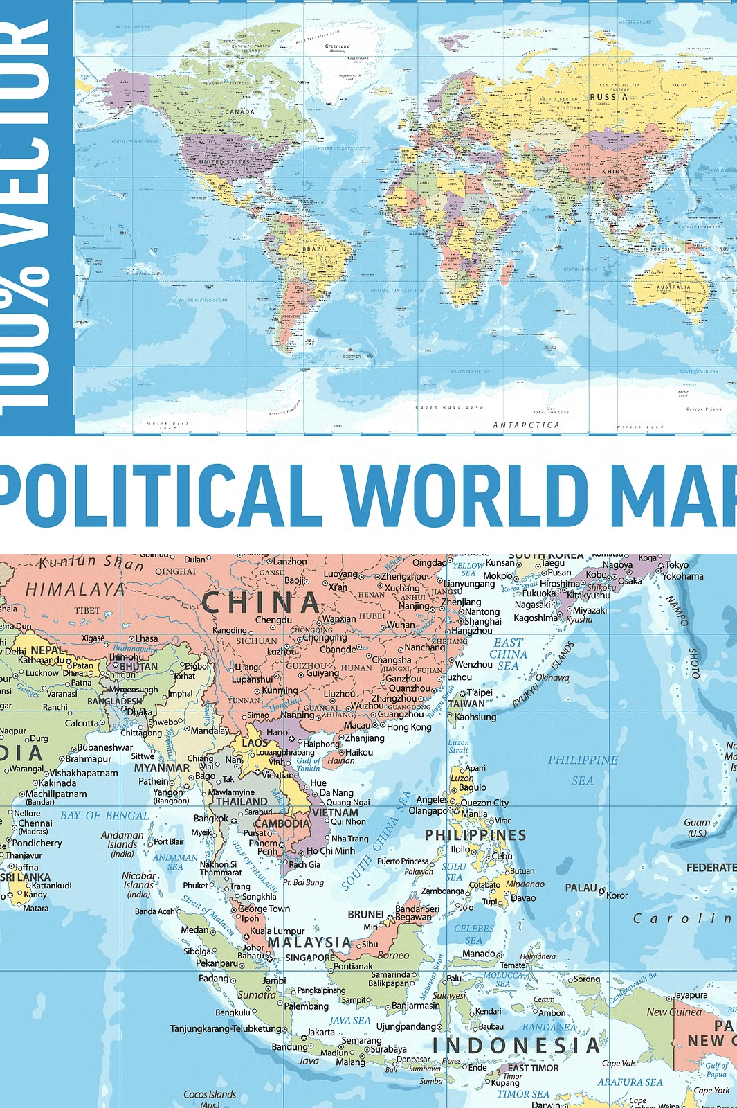
Professional-Grade, Fully Layered World Map for Any Creative Use
Unleash the power of precision and flexibility with the **Political World Map Vector Layered Collection**—a meticulously crafted, high-resolution digital map designed for professionals, educators, designers, and creators who demand versatility and quality. Built from scratch with advanced vector technology, this map features a multi-layered structure that allows you to isolate and manipulate individual elements with ease—perfect for any scale, size, or application, without losing a single pixel of clarity.
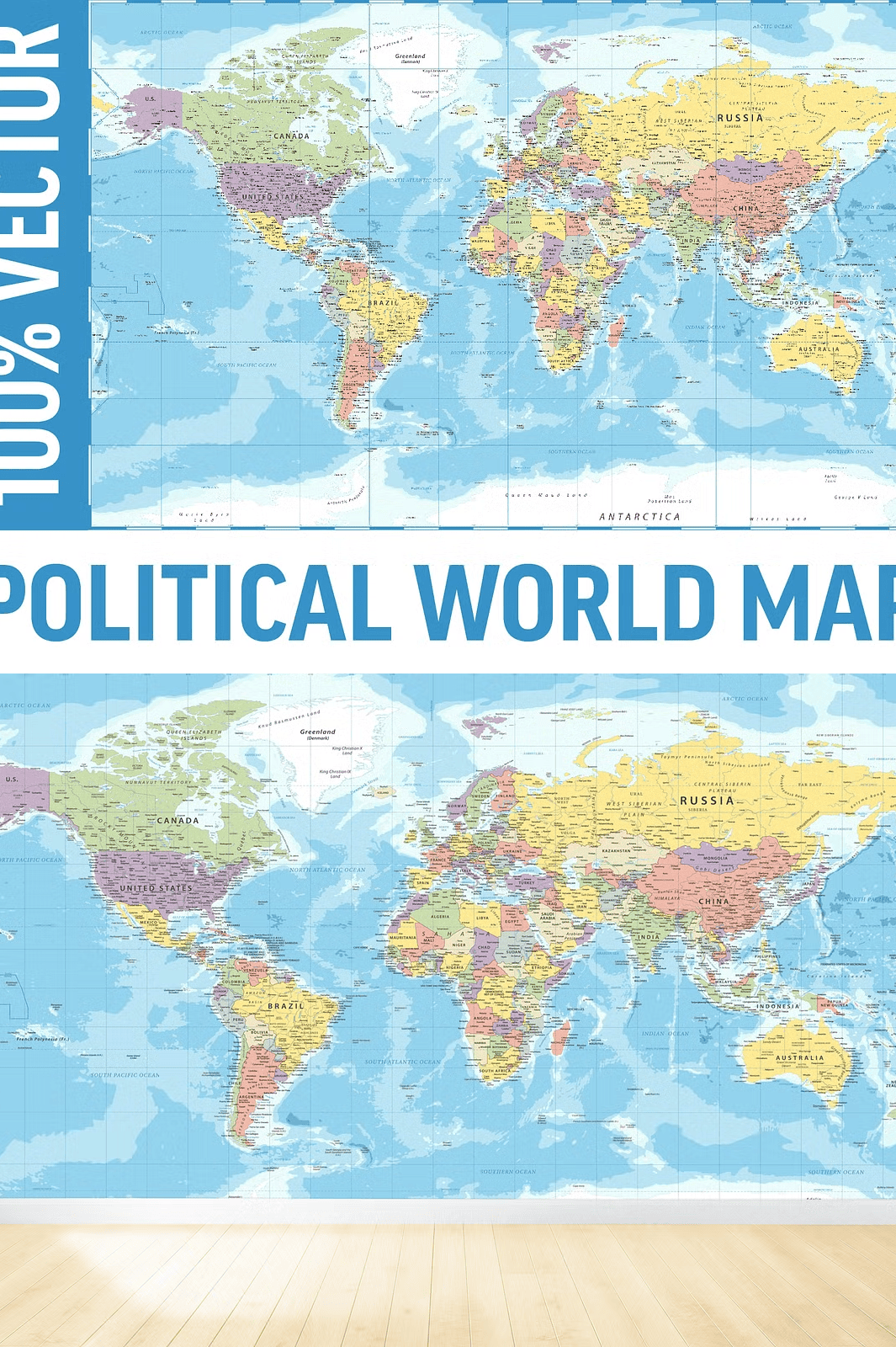
Whether you’re designing large-format wall art, crafting detailed presentations, creating print-on-demand merchandise, or producing educational materials, this map delivers unmatched precision and visual impact. Each geographic feature is carefully detailed and professionally organized, ensuring optimal performance across digital and physical platforms.
Explore an Extensive Selection of Highly Detailed Geographic Elements
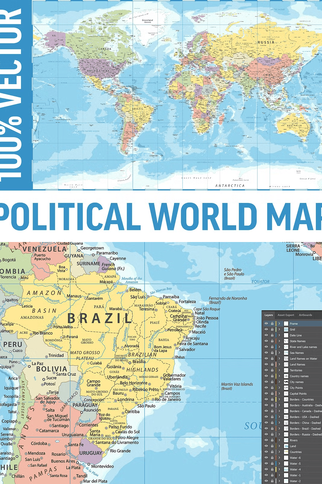
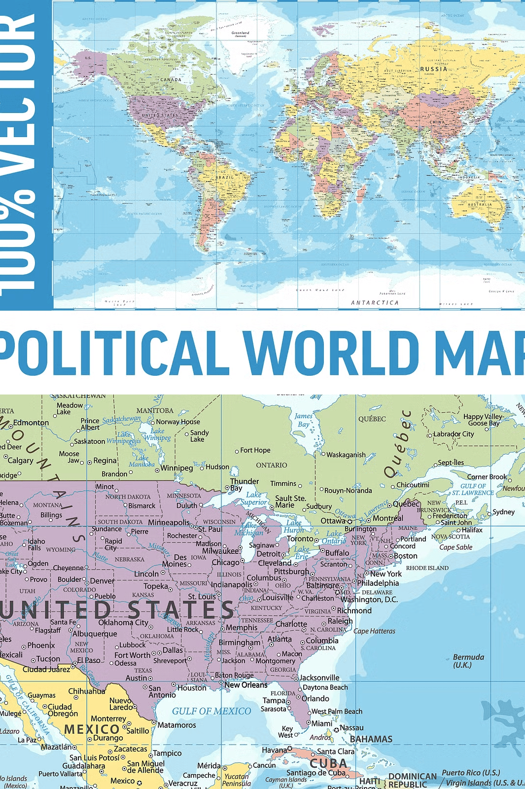
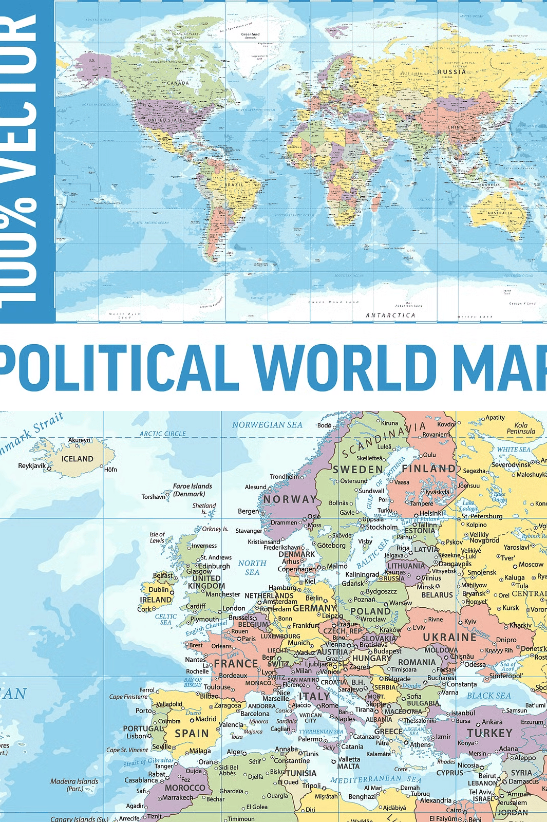
This map is more than just a visual representation—it’s a dynamic tool packed with over 20 distinct layers, all fully editable and organized for maximum efficiency:
– **Country Boundaries & Names**: Clearly labeled national borders with accurate naming and consistent typography for global recognition.
– **Capitals & Major Cities**: Marked with precision, ideal for geographic analysis, educational content, or interactive design.
– **State and Regional Borders**: Fully detailed administrative divisions with smooth, clean outlines for enhanced clarity.
– **Rivers, Lakes, and Seas**: Detailed waterways and inland bodies, accurately placed to reflect real-world geography.
– **Oceans and Continents**: Smooth, stylized landmass shapes with seamless transitions and clean edges for aesthetic appeal.
– **Topographical Features**: Mountains, valleys, deserts, and plateaus highlighted with subtle shading for depth and realism.
– **Date Lines and Graduated Grid**: Complete meridian and parity lines with labeled intervals, perfect for navigation-focused projects and scientific visuals.
– **Compass Rose and Scale Indicator (Optional)**: Included upon request for mapping and educational purposes.
All layers are clearly named and organized in a logical hierarchy—no more guessing which layer contains what. You maintain full control over transparency, coloring, and placement.
Multi-Format Accessibility for Every Design Need
The ZIP archive includes **six professional-grade file formats** to ensure compatibility with your workflow:
– **AI (Adobe Illustrator)** – Full vector editing with layers intact.
– **EPS (Encapsulated PostScript)** – Universal vector standard, ideal for print and publishing.
– **SVG (Scalable Vector Graphics)** – Perfect for web use, responsive design, and interactive elements.
– **PDF (Portable Document Format)** – High-quality output for presentations and sharing.
– **HI-RES JPEG (High-Resolution Raster)** – Ideal for non-vector applications, web backgrounds, or digital sharing.
Each format retains the map’s full resolution and layering structure where applicable. The AI and EPS files include **all 20+ layers**, so you can edit, recolor, or restructure the map with complete freedom.
Optimized for Print, Web, and Product Design
This map isn’t just beautiful—it’s built for real-world application:
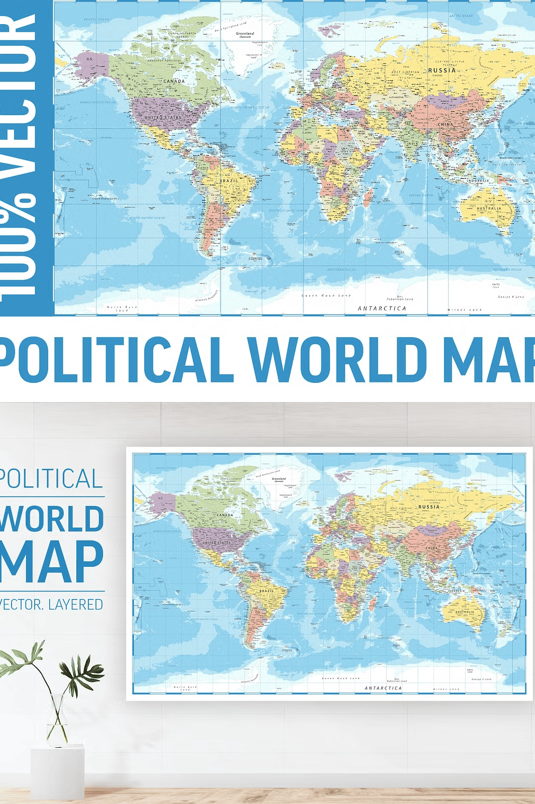
– **Large-Format Printing**: Ideal for posters, murals, classroom displays, and office wall art. No pixelation, no loss of quality—even at 300 DPI.
– **Digital Presentations**: Use in PowerPoint, Google Slides, Keynote, or video editing tools with crystal-clear visuals.
– **Educational Content**: A go-to resource for teachers, students, and researchers creating geography reports, infographics, or lesson plans.
– **Print-on-Demand Products**: Easily integrate into t-shirts, notebooks, mugs, tote bags, coasters, and planners without quality degradation.
– **Website and App Design**: Use as background graphics, interactive maps, or navigation aids in responsive design.
The layered structure ensures you can customize the map for any context—remove background features, highlight specific regions, or create animated versions.
Commercial Use Ready with No Hidden Restrictions
All usage rights are clear and fully permitted under a commercial license:
– ✅ Use in client projects
– ✅ Use in profit-generating products
– ✅ Use across websites, social media, and digital storefronts
– ✅ Use in physical goods (no need to redesign)
Note: Fonts used are for display only—**not included** and **not editable**, so please ensure you use a compatible typeface or embed your own.
Transform Your Projects with a World-Class Geographic Resource
Stop searching for generic, low-detail maps. The **Political World Map Vector Layered Collection** is your definitive tool for accuracy, creativity, and professional delivery. Whether you’re teaching geography, branding a global campaign, or designing a world-themed product, this map gives you the power to stand out.
From classrooms to creative studios, from startups to corporate teams—this map adapts to your vision, not the other way around.