Unlock the Power of Precision Maps for Every Project
Elevate your teaching, design, or content creation with this **Collection of World Vector Maps**, a meticulously crafted set of four high-quality, layered vector illustrations designed for maximum flexibility and professional-grade results. Whether you’re preparing classroom materials, building travel content, or developing digital art, these maps provide accurate, scalable, and fully customizable visuals that deliver impact at any size.
Each map is engineered for seamless integration across Adobe Illustrator, Canva, InDesign, PowerPoint, and other design platforms. No more blurry images or stretched graphics — just crisp, clean vectors built to last.
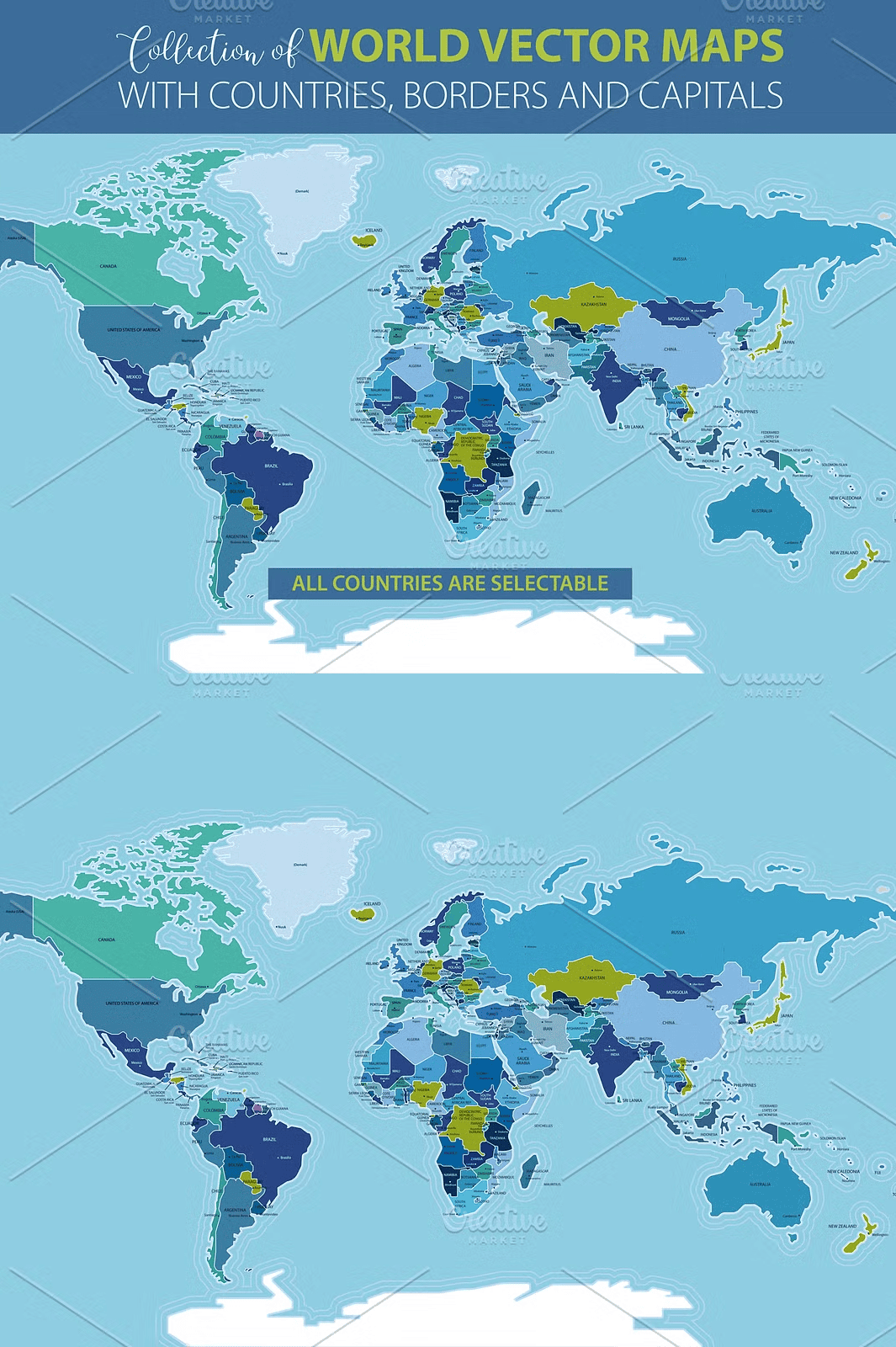
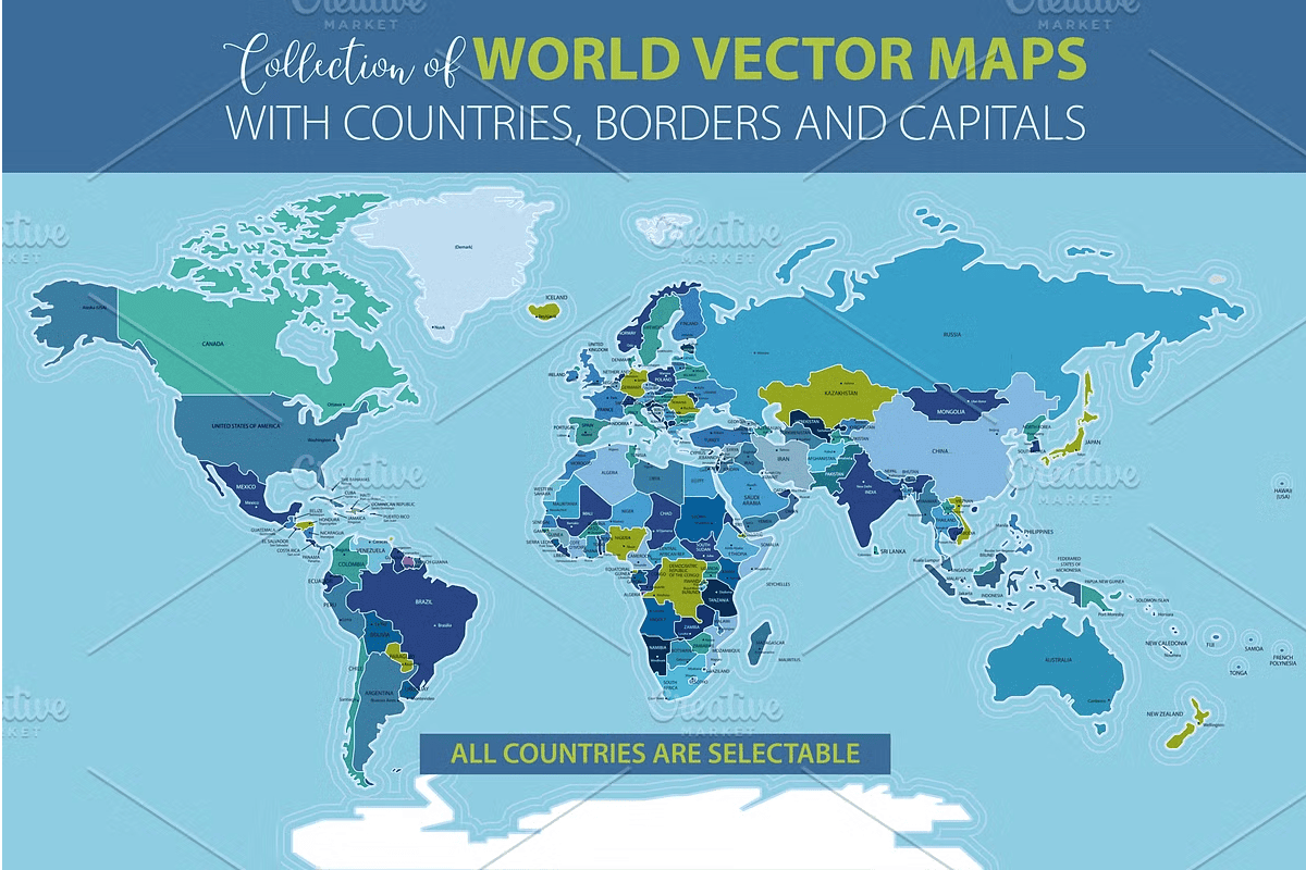
Complete Map Set: Borders with Countries and Capitals
– A detailed global map displaying national borders, precise country names, and capital city labels.
– Perfect for geography lessons, world history projects, student research, and interactive learning tools.
– Layered structure lets you isolate features, adjust colors, or add custom annotations without disruption.
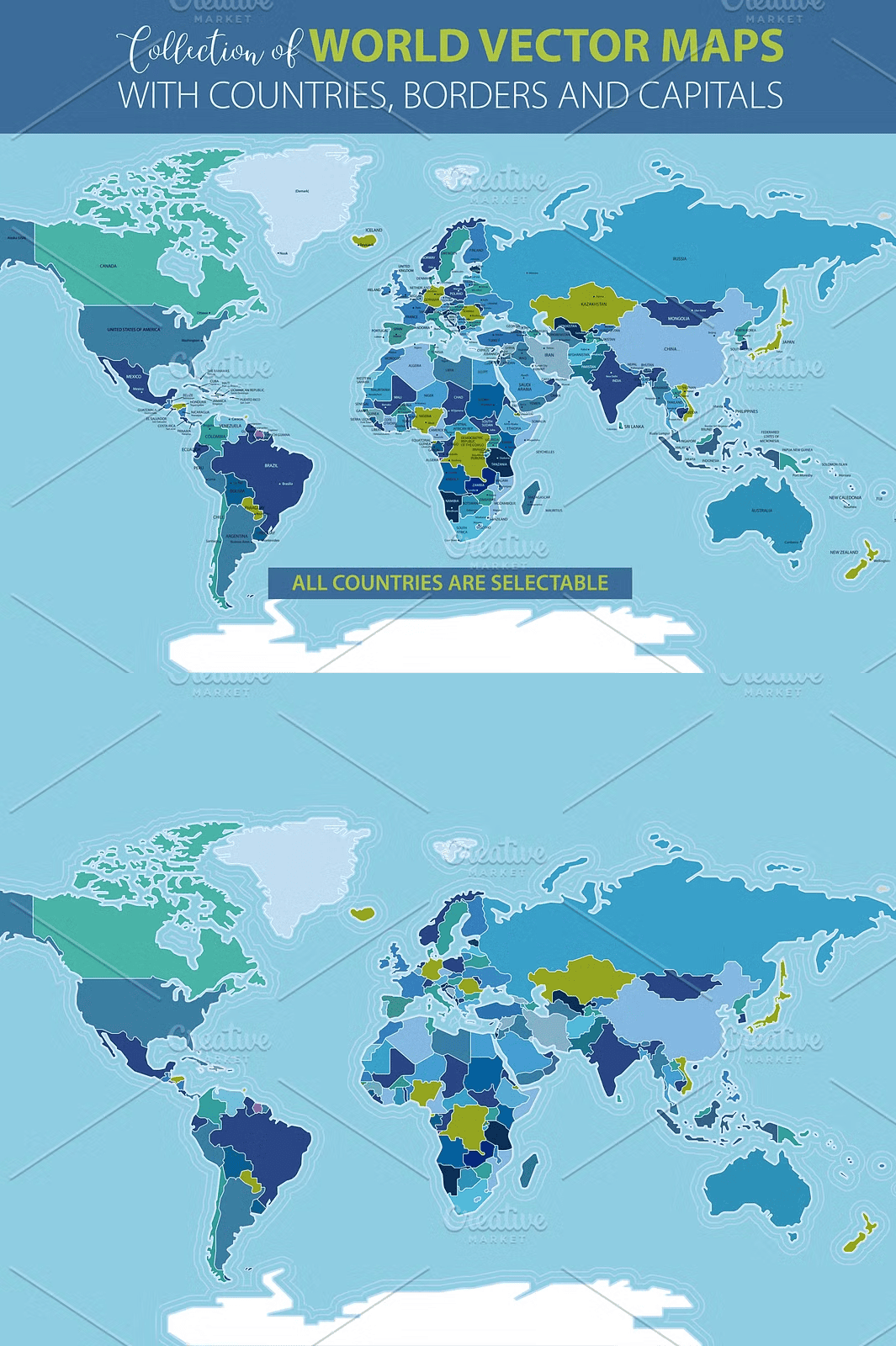
Minimalist Borders-Only Map for Clean Design Focus
– Clean, uncluttered representation showing only country outlines.
– Ideal for background textures, puzzles, coloring books, or visual comparisons between regions.
– Easily layer over photos, gradients, or thematic maps to create unique compositions.
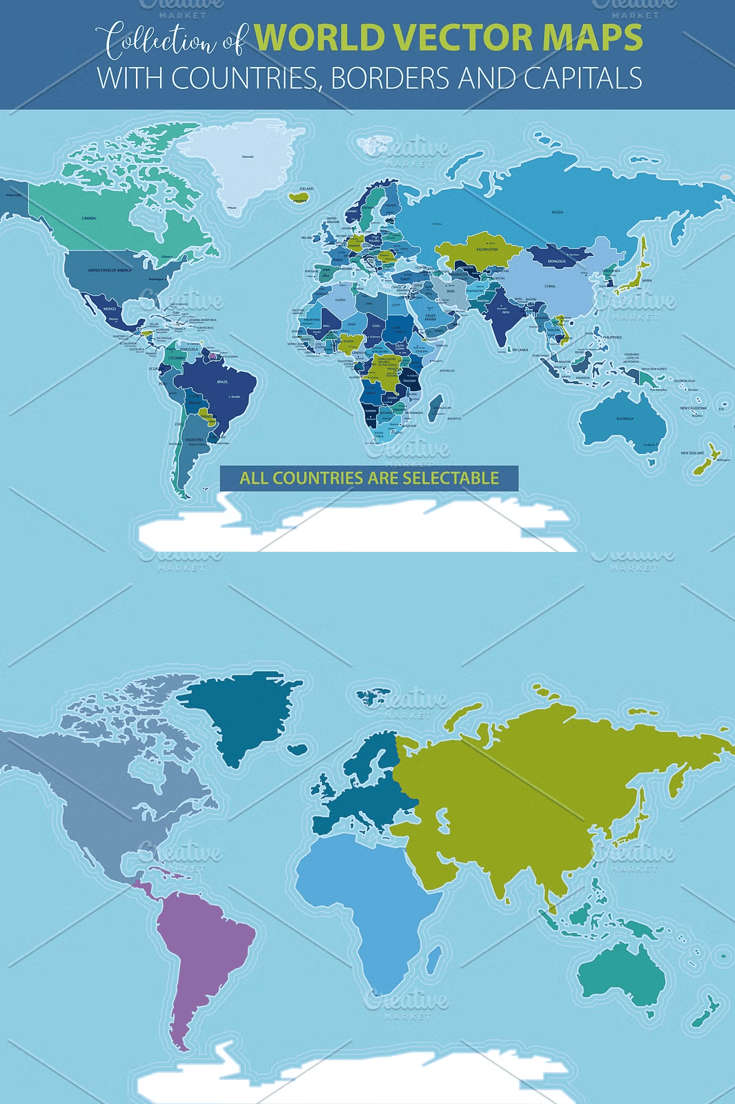
Continents-Only Map for Global Understanding
– Highlights the major landmasses of Earth without political boundaries.
– Designed to teach continent shapes, relative sizes, and geographic relationships.
– Great for early learners, elementary science classes, and world awareness activities.
Full World Map in Editable Layered Format
– Complete, full-featured globe with all elements accessible as separate layers.
– Allow you to independently adjust colors, opacity, or visibility of continents, borders, or labels.
– Use it as a digital canvas to insert icons, data points, historical events, or travel routes.
Professional-Grade Files for Print and Digital Success
Every map comes in multiple formats to suit all your creative and publishing needs:
– **Adobe Illustrator (.AI)** – Full layer support, editability, and scalability.
– **EPS10** – Widely compatible with legacy software and vector editing tools.
– **PDF** – Print-ready, high-resolution, and suitable for direct distribution.
– **SVG** – Responsive and scalable for web use, apps, and mobile interfaces.
– **High-Resolution JPG (300 DPI, 7000 px width, RGB)** – Crisp, publication-quality images for web and print.
All files are delivered in the highest quality with no compression artifacts, ensuring perfect clarity from a small thumbnail to a large wall poster.
Endless Customization for Diverse Creative Applications
With full vector editing capabilities, you can:
– Recolor individual countries or continents for thematic mapping (e.g., climate zones, economic data, historical empires).
– Add icons, flags, timelines, or weather patterns to create data-driven infographics.
– Design interactive digital quizzes, travel itineraries, or classroom games.
– Combine multiple maps into a panoramic world view or animated sequences.
Power Every Educator, Designer, and Content Creator
This map collection empowers professionals across industries:
– **Teachers and homeschool educators** – Create engaging geography units, student workbooks, and classroom displays.
– **Travel bloggers and content creators** – Develop stunning visual stories for blog posts, social media, and e-books.
– **Digital artists and illustrators** – Use as foundation for fantasy maps, worldbuilding projects, or themed artwork.
– **Print-on-demand sellers** – Design premium wall art, posters, and notebooks for Etsy, Amazon KDP, and Printful.
– **Students and researchers** – Build visually rich reports, presentations, and project displays with authoritative visuals.
No more compromising on quality or flexibility — this set gives you everything you need in one powerful, ready-to-use bundle.