Highly Detailed & Professionally Crafted Vector Maps
Unlock the full potential of your design projects with this meticulously crafted Detailed USA Map Vector Illustration Pack. Designed for precision and versatility, this collection features five high-quality vector files in EPS10 format, capturing every state boundary with crystal-clear accuracy. The map includes full state outlines, national borders, and customizable labels—perfect for educators, cartographers, designers, and content creators.
Each file is fully editable, allowing you to modify text, colors, layers, and styling to match your visual identity. Whether you’re building a classroom lesson, launching a marketing campaign, or creating custom merchandise, this vector set ensures professional results that scale flawlessly without pixelation.
Five Versatile Map Variations for Every Purpose
This pack doesn’t just deliver one map—it provides a full suite of configurations to suit diverse needs:
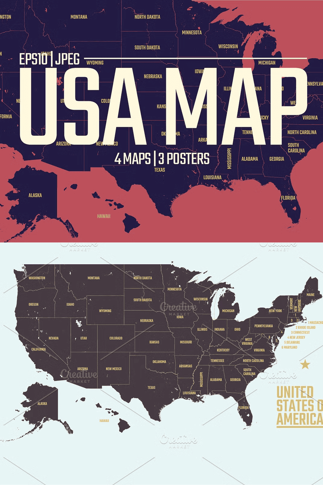
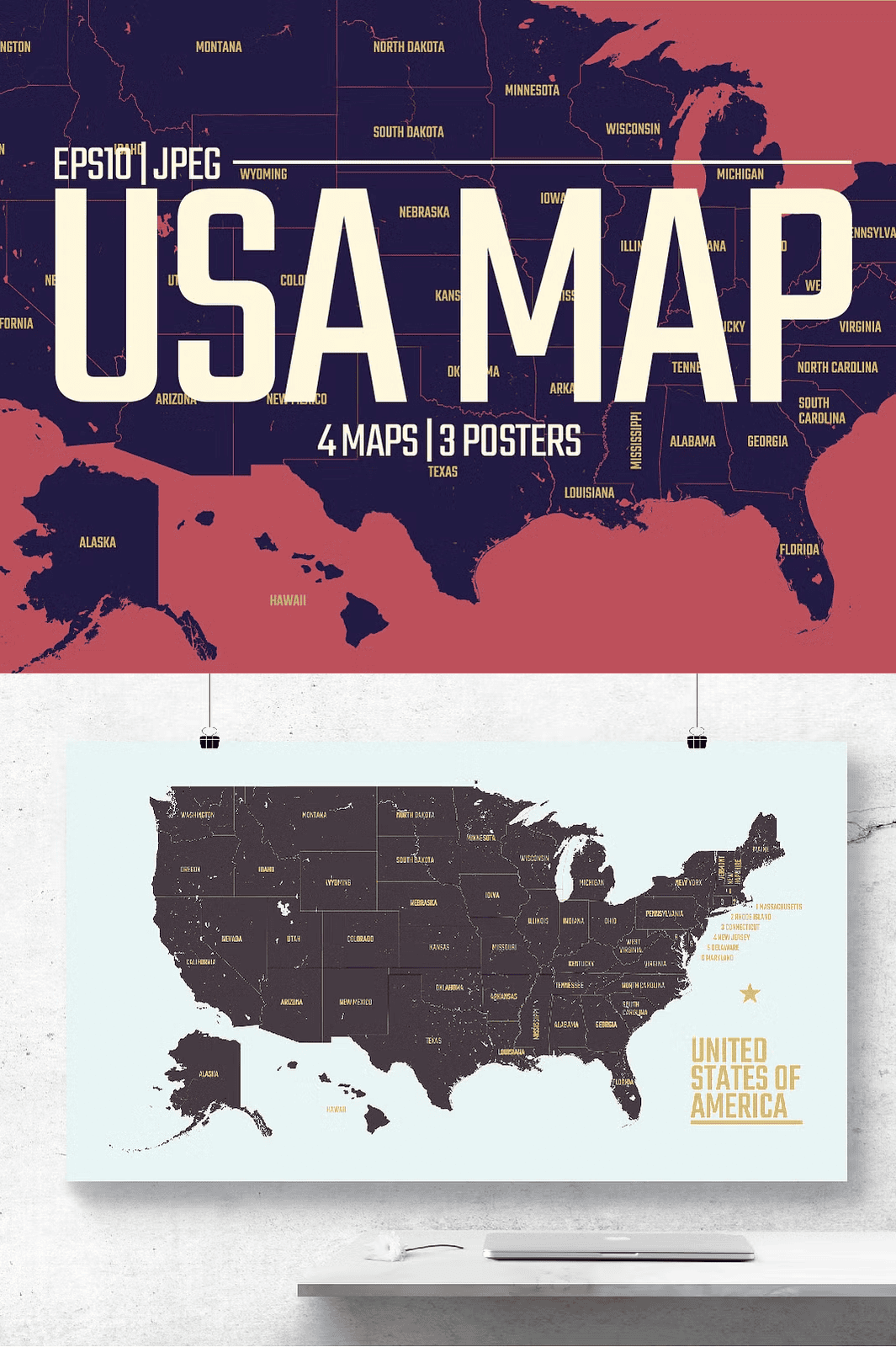
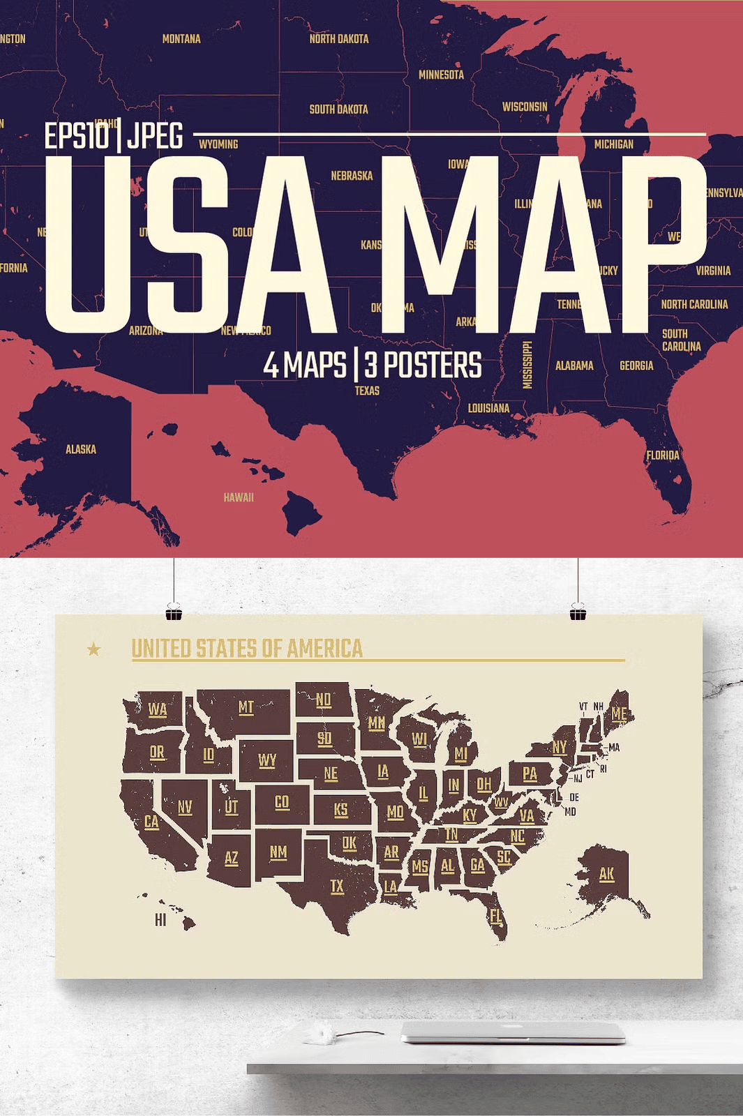
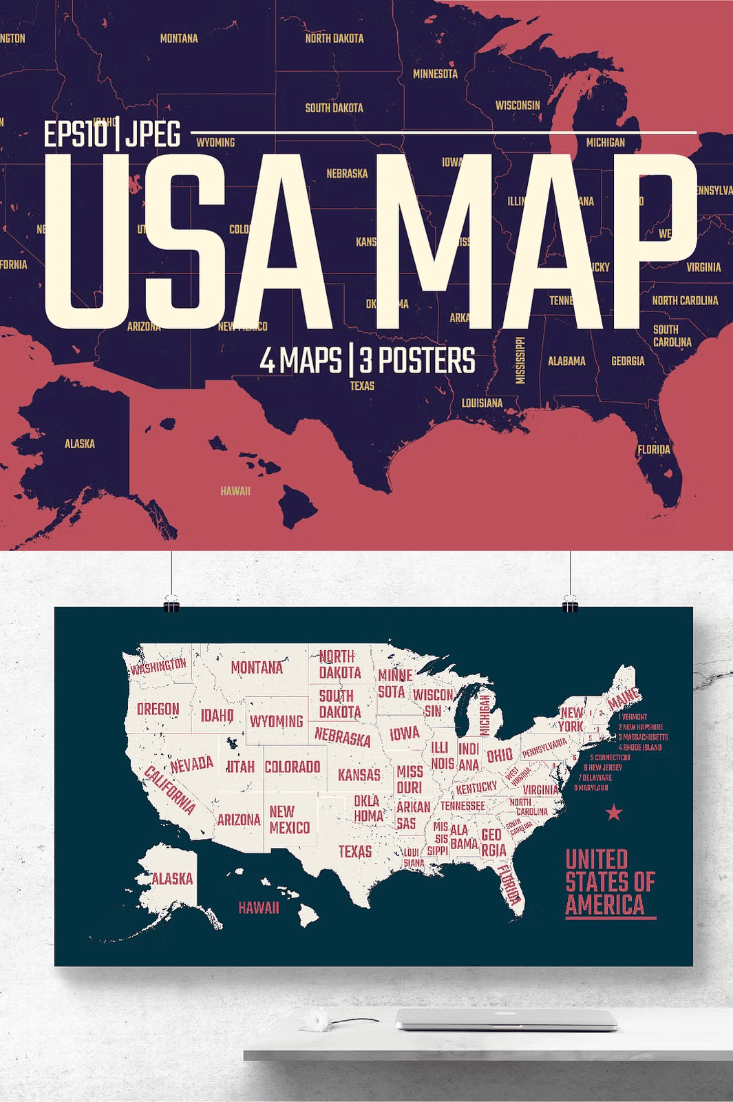
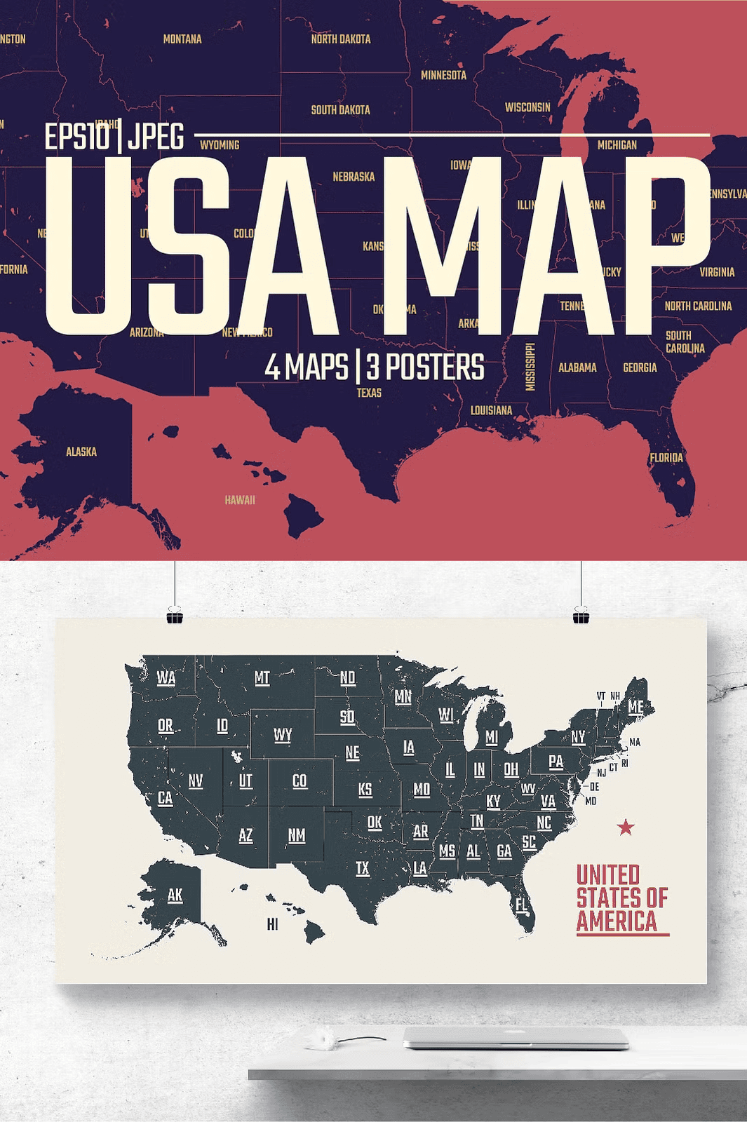
– Full USA Map with State Borders: Complete national layout with clearly defined state lines, ideal for maps, presentations, and geographic education.
– State Name Labels Edition: Every state labeled for clear identification—perfect for educational materials, travel guides, and learning tools.
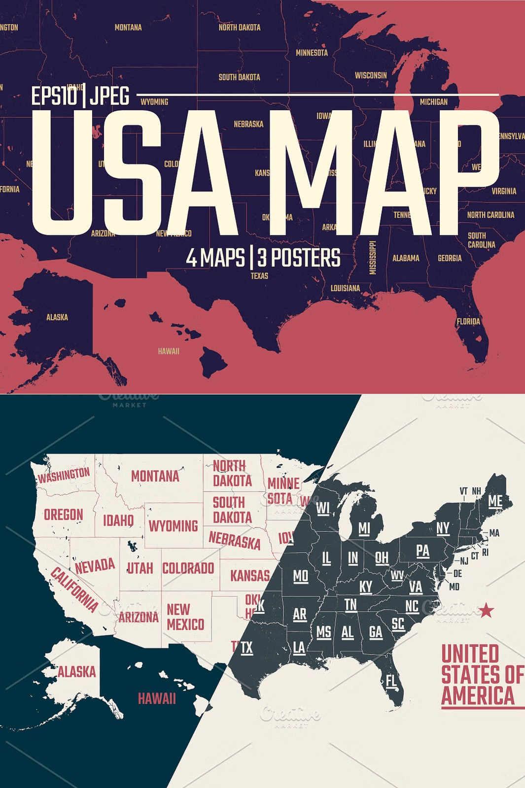
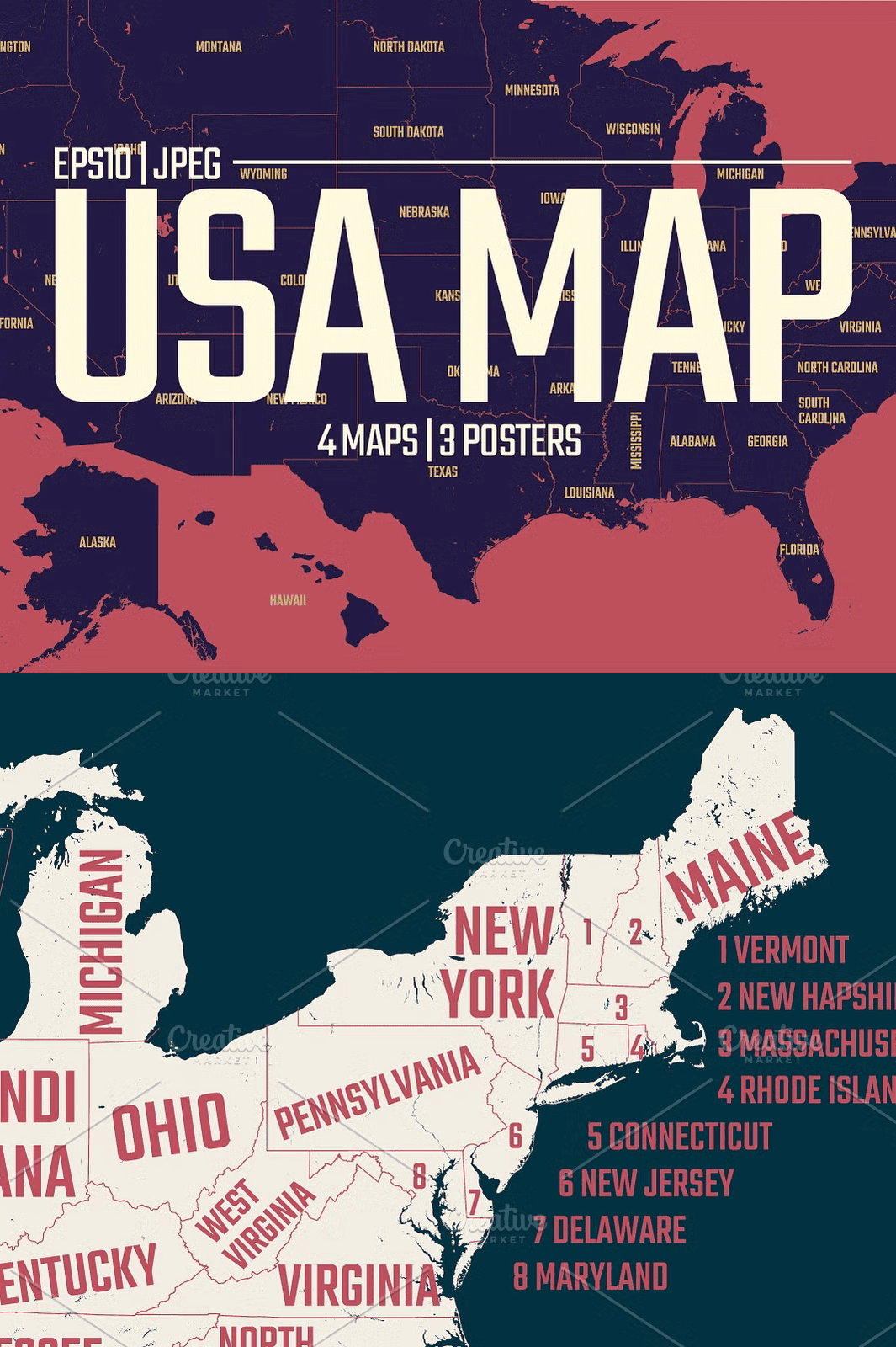
– Regional Breakdown Maps: Separate versions highlighting different regions (Northeast, Midwest, Southwest, etc.) for thematic or comparative storytelling.
– Outline-Only Version: Clean, minimal design without labels—ideal for overlay work, branding, or custom labeling.
– Customizable Themed Map: A blank state map with editable text fields, perfect for creating interactive content or event signage.
All files are optimized for professional use and maintain flawless detail at any scale.
High-Resolution JPEGs for Print & Digital Use
In addition to vector files, you receive seven high-resolution JPEGs (8889x5000px, 300 DPI) for maximum flexibility. These are ready to use in web design, social media posts, print projects, banners, wall art, and more.
Each JPEG is processed with advanced anti-aliasing and sharpening, ensuring sharp clarity even when enlarged. The dark, clean background enhances readability and contrast, making the map visually striking for both digital and printed formats.
Licensed Typography for Seamless Integration
The font used throughout the map labels is Teko, a bold, modern sans-serif typeface available under the Open Font License (Google Fonts). It features excellent readability at small sizes and a strong visual presence, making state names clear and impactful. No additional font installation is required for standard use, and the design remains clean and professional.
Powerful Features for Educators, Designers, and Creative Professionals
This map collection is engineered for real-world applications:
– For Teachers & Educators: Design engaging geography lessons, quizzes, classroom maps, or student projects. Use the editable labels to challenge learners with interactive map activities.
– For Marketing & Branding Teams: Incorporate the map into regional campaigns, website sections, or event promotions. The clean vector format ensures crisp rendering on any device.
– For Print-on-Demand Sellers: Use the high-DPI files to produce high-quality posters, wall maps, calendars, and books. Perfect for platforms like Etsy, Printful, or Amazon.
– For Content Creators & Bloggers: Create visually rich blog posts, infographics, travel guides, or social media content with authoritative visuals.
– For Web & UI Designers: Seamlessly integrate the map into dashboards, interactive websites, or apps with responsive layouts.
Instant Access, Professional Results, Zero Compromise
No waiting. No shipping. Just instant download after purchase. Get started on your next creative or educational project in seconds.
All files are organized in a clean, intuitive folder structure. Simply unzip and access your design assets immediately—no technical setup required.
This product is licensed for personal and commercial use under Creative Market’s terms. Redistribution or resale of the original files is strictly prohibited.
For support, questions, or custom requests (such as additional region maps, different color schemes, or file format conversions), contact: maximgertsen@creativemarket.com
Follow the creator: Instagram
Learn more about licensing: Creative Market License Terms
Looking for more high-quality maps?
Explore additional collections:
Europe Maps Vector Pack
City Maps Vector Package