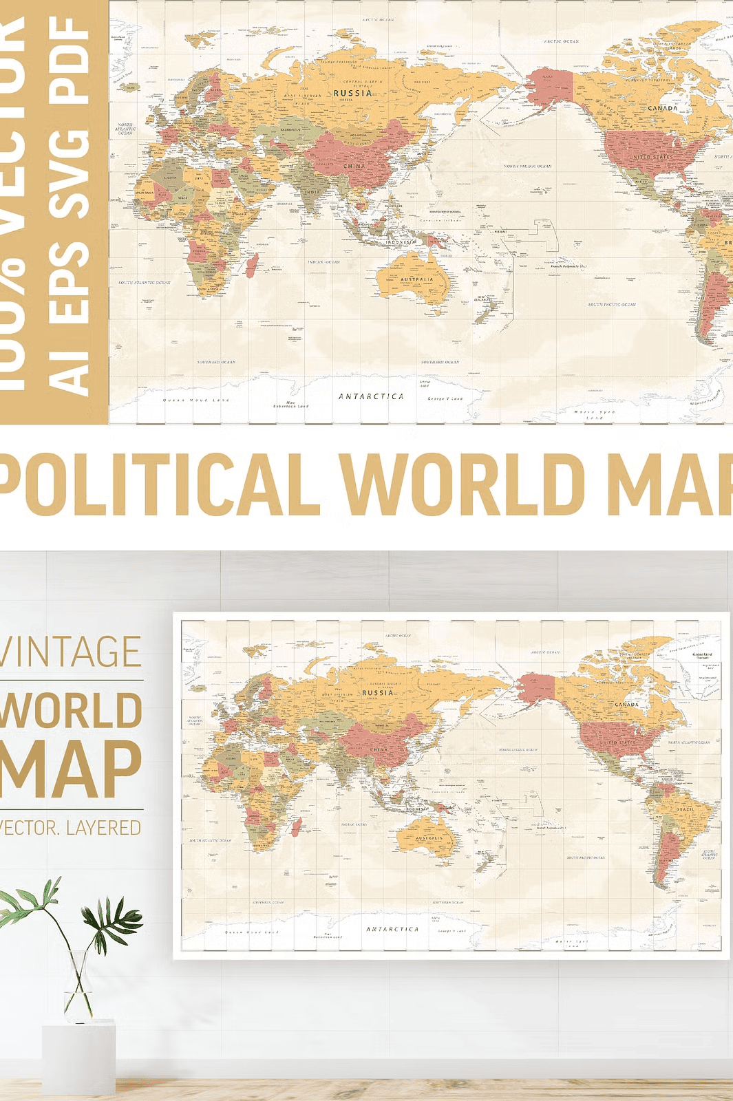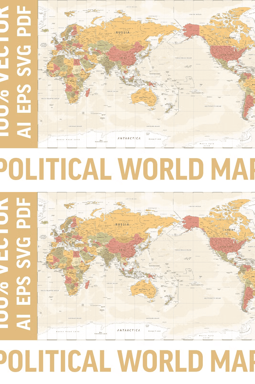
Explore the World with a Fully Layered, High-Detail Vector Map – No Quality Loss at Any Scale
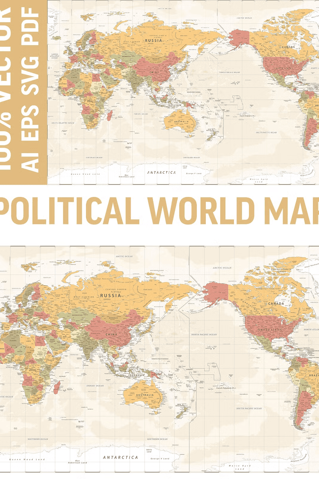
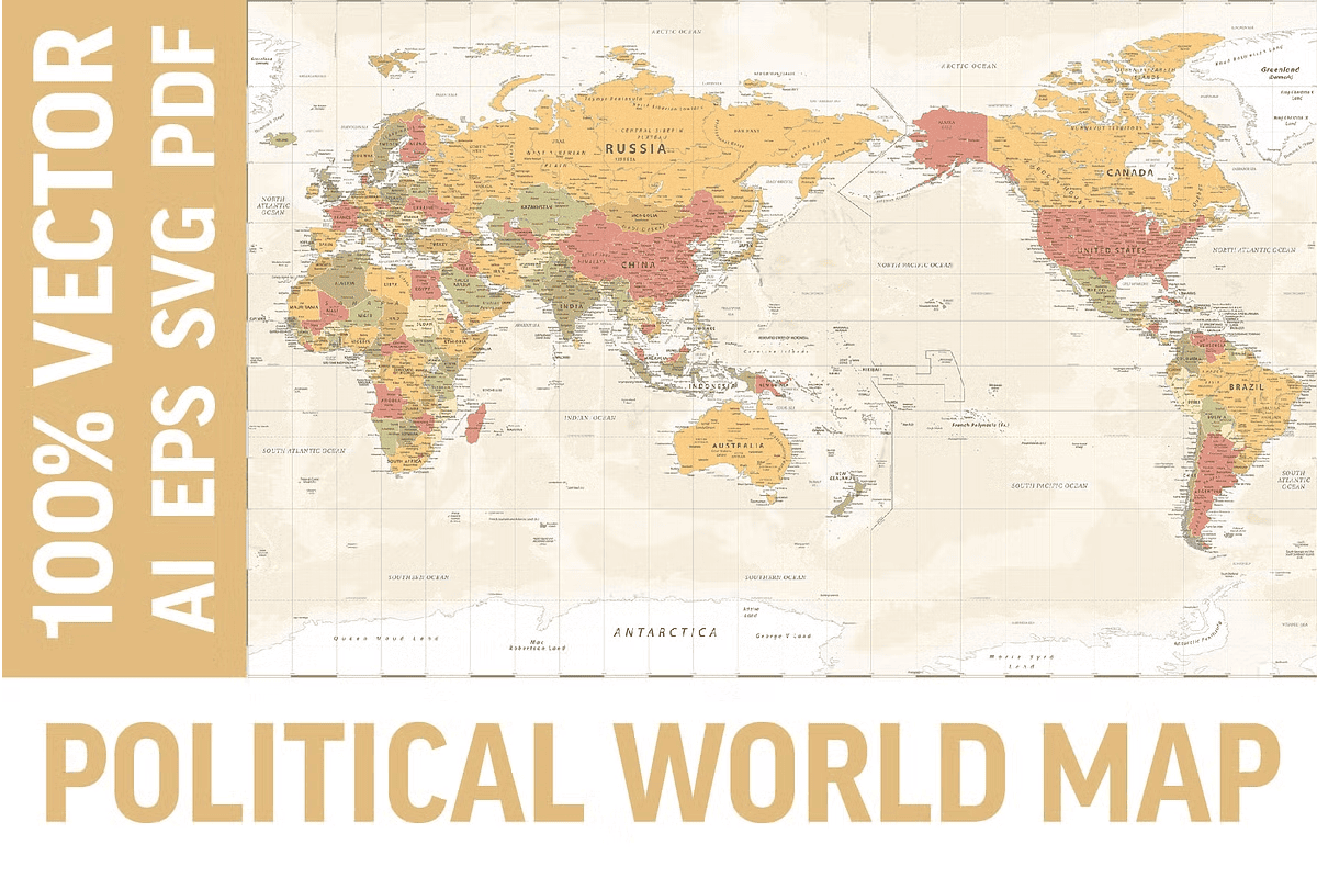
Elevate your design projects with this meticulously crafted **World Political Map (Pacific Edition)** a fully vectored, multi-layered map engineered for unmatched scalability and precision. Whether you’re creating a high-impact poster, a large-format mural, a professional presentation, or an educational resource, this map delivers crystal clear detail regardless of size. Every line, label, and geographic feature is preserved perfectly when resized because it’s built in true vector format.
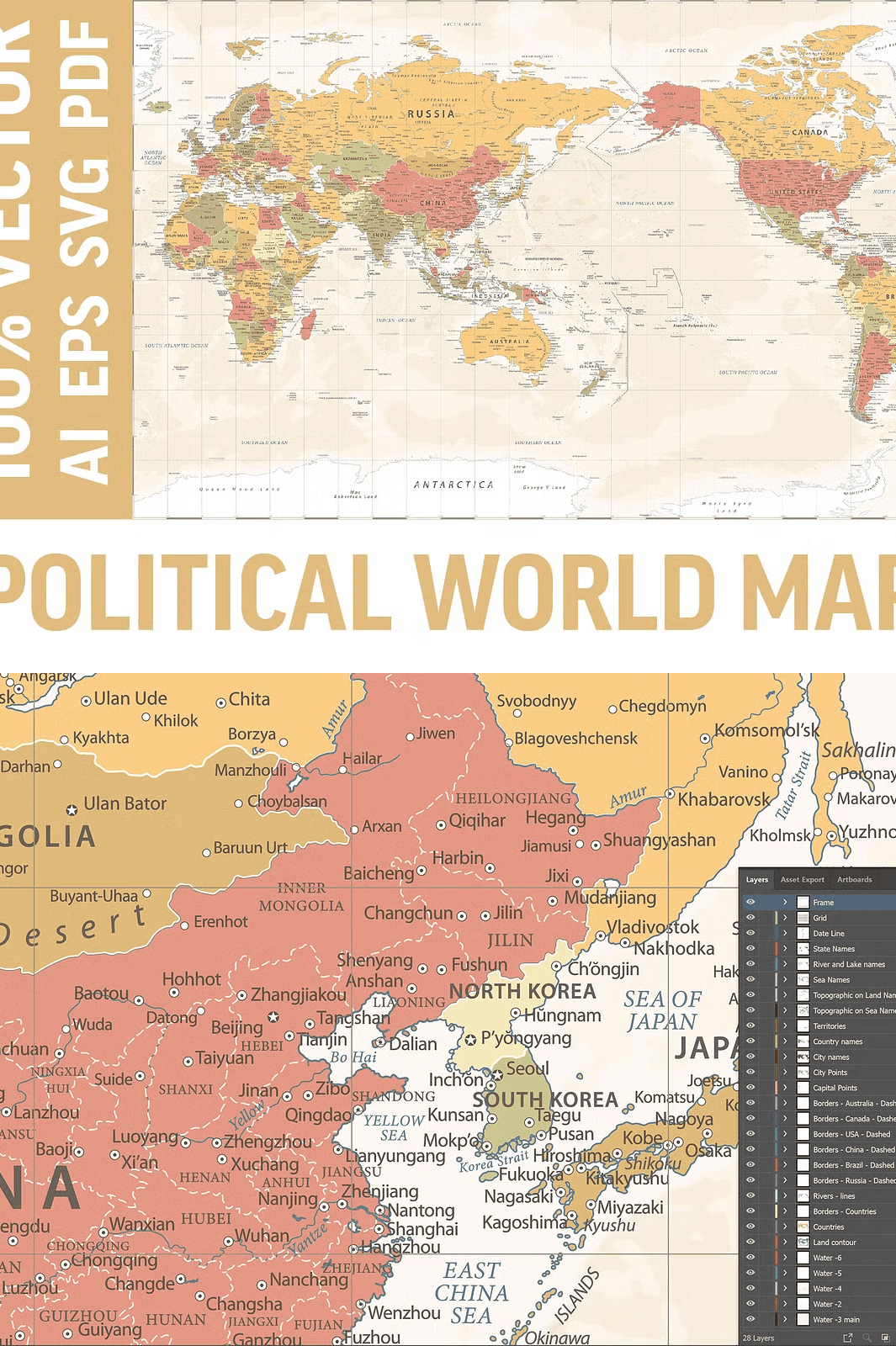
Designed with professional usability in mind, the map offers **separate editable layers** in AI and EPS files, so you can selectively display or hide features like country borders, city markers, rivers, or topographic lines. Customize your visual narrative with ease and efficiency.
Rich Geographic Detail for Professional and Educational Use
This map is packed with essential geographic elements for accurate and engaging representation:
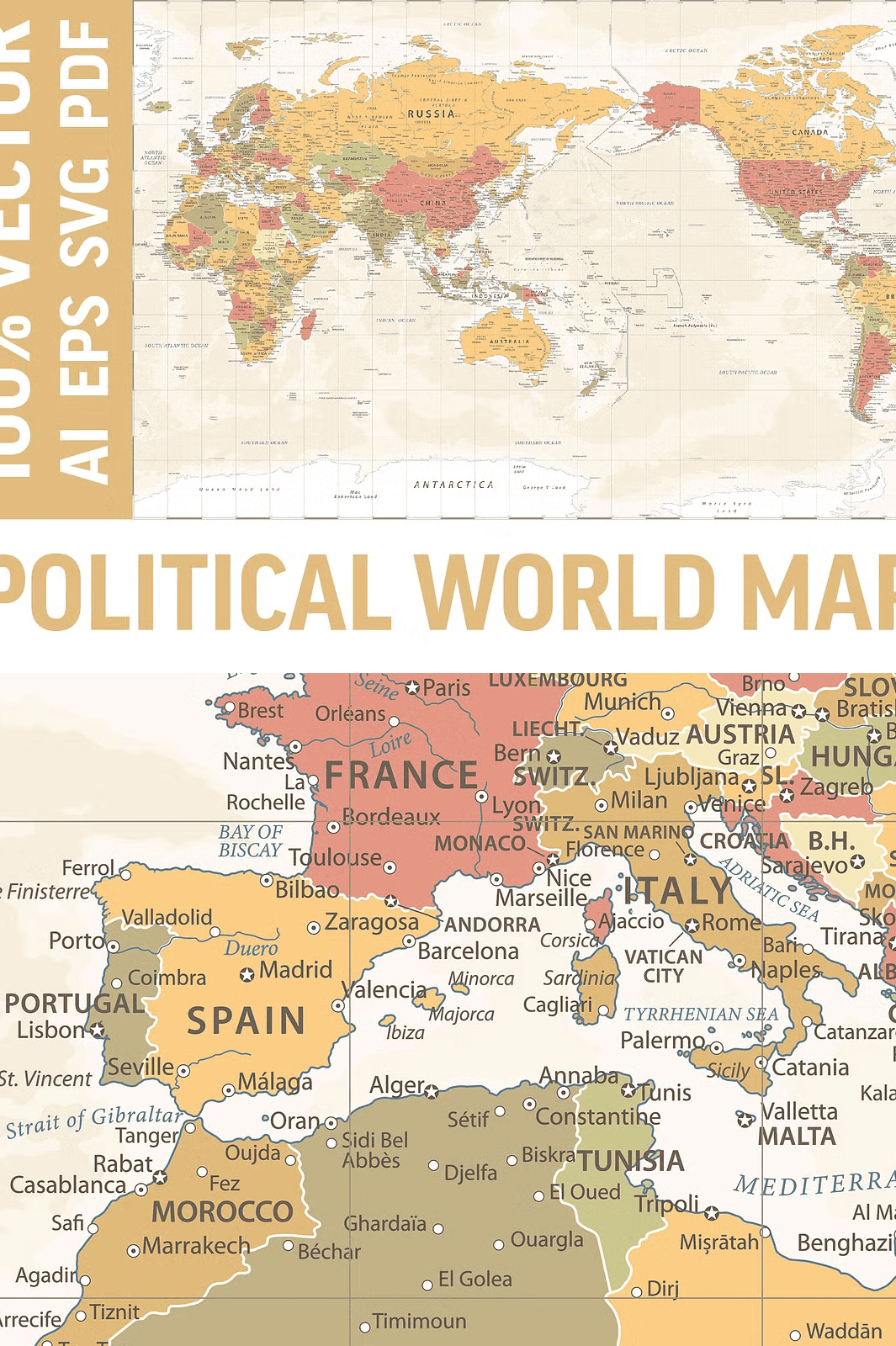
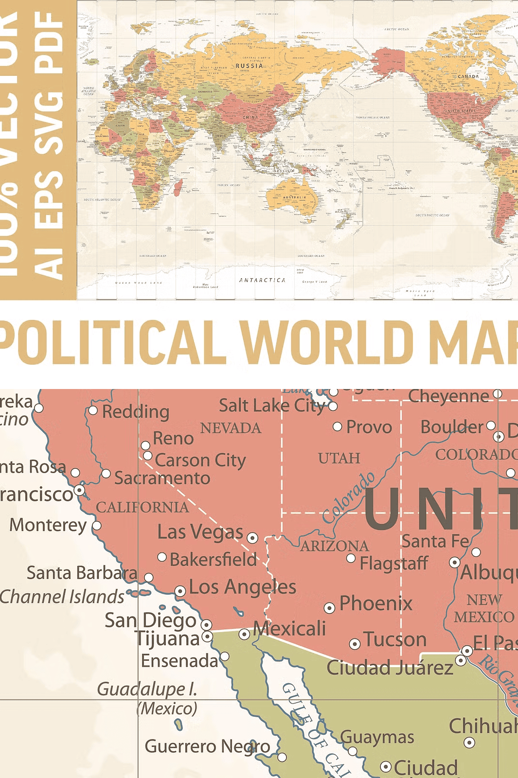
– **Countries and state borders** with clear, distinct outlines
– **Capitals and major cities**, clearly labeled for fast identification
– **Rivers, lakes, seas, and oceans** with detailed flow and boundaries
– **Mountains, deserts, and valleys** annotated for topographic understanding
– **International date line** and **graduated longitude/latitude grid** for navigation accuracy
– **Consistent, modern styling** with clean typography and balanced visual hierarchy
Perfect for classrooms, offices, or home décor, this map brings global insight to any space with a professional and polished finish. Use it as a visual anchor on a wall or as a reference in digital presentations.
Powerful File Formats Designed for Every Creative Workflow
The ZIP archive includes **multiple professional-grade file formats** to ensure compatibility with any design software:
– **AI10 (Adobe Illustrator)** – Layered project files for full editing control
– **EPS10** – Industry-standard vector format with embedded layer structure
– **SVG** – Lightweight scalable format ideal for web and digital displays
– **PDF** – Print-ready layout with vector clarity and embedded layers
– **HI-RES JPEG** – High-definition raster image for quick preview or non-editable use
All vector files are compatible with Adobe Creative Cloud, Affinity Designer, CorelDRAW, Inkscape, and similar tools. The layers are clearly named and organized to streamline your workflow.
Important Note: Font Limitations
Please note: **Fonts are not included** in this map and are not editable. Any text elements such as country or city names are in static vector form. While you can recolor and resize labels, re-editing text content requires external font installation.
Endless Applications for Personal, Educational, and Commercial Projects
This versatile map is more than just a display piece — it’s a dynamic tool for design and education:
– **Print and wall art** – Use for office, classroom, or home décor
– **Presentations and slide decks** – Add depth and professionalism to reports or lectures
– **Educational materials** – Ideal for geography lessons, school projects, and study guides
– **Website visuals** – Enhance digital storytelling with interactive map layers
– **Product design** – Use as a base for mugs, apparel, puzzles, calendars, and wall decals
– **Brand and corporate communication** – Support international expansion messaging with visual clarity
Get Instant Access – Download Your Map Today
Note: This is a digital product only. No physical items are shipped. License covers personal and commercial use (terms apply). Fonts used in labels are not included and cannot be edited. Color accuracy may vary slightly depending on display or print settings. Always verify your license terms before commercial distribution.