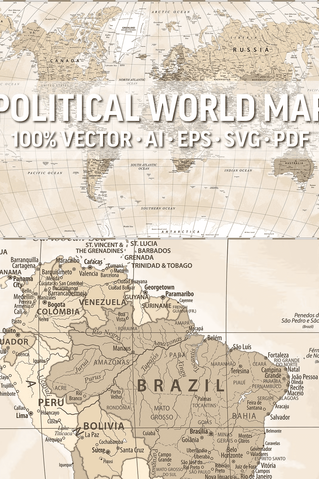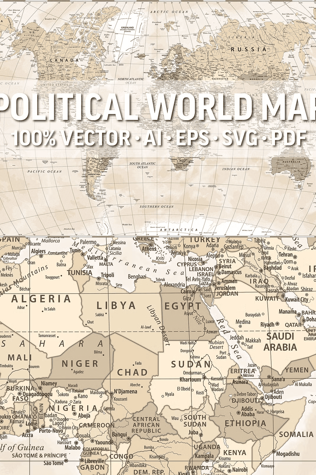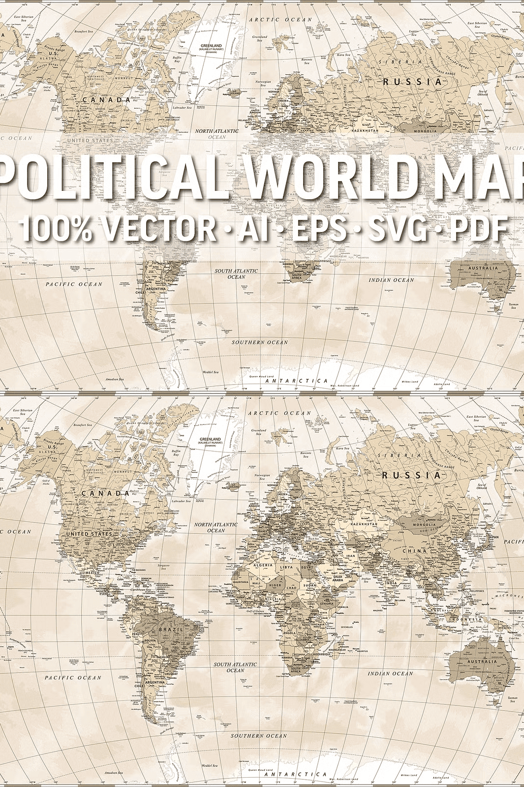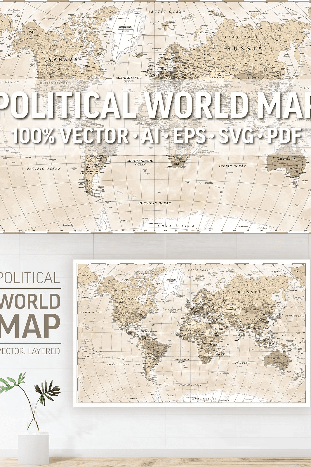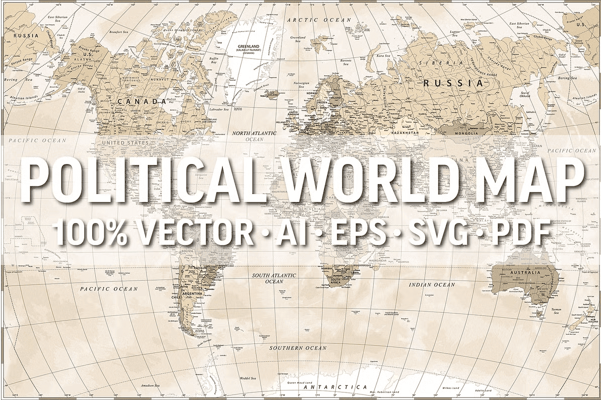
Unleash Precision and Flexibility with a Highly Detailed Vector Map
Transform your design projects with a professionally crafted, fully layered World Political Vector Map engineered for maximum scalability, clarity, and creative control. Unlike low-resolution or flattened images, this map is built from dozens of independent layers, ensuring that every element remains editable and crisp at any size from a small infographic to a large-scale mural or wall art.
Whether you’re designing a classroom poster, crafting a business presentation, creating digital content, or producing physical merchandise, this vector map delivers seamless performance. The use of high-precision lines, detailed borders, and a clean yet informative layout makes it a standout asset for educators, designers, marketers, and content creators.
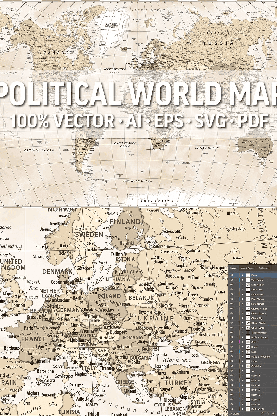
Explore 14 Organized, Editable Layers for Maximum Customization
This map includes 14 separate layers that give you total control over what’s visible and how it’s styled. You can isolate and manipulate individual elements without affecting others:
– Countries – Fully outlined with accurate international borders
– Country Names – Clearly labeled for recognition and reference
– Capitals – Highlighted for geographic context and learning tools
– Major Cities – Marked with precise placement
– State & Regional Borders – Useful for country-specific designs
– Lakes & Rivers – Detailed water features with natural flow logic
– Seas and Oceans – Clearly differentiated with clean outlines
– Topography – Shows major mountain ranges, valleys, and terrain features
– Date Lines – Accurately placed to match global time zones
– Graduated Grid System – Includes latitude and longitude lines for cartographic accuracy
Each layer is cleanly named and structured, making it simple to turn layers on or off, recolor sections, add drop shadows, and integrate into any project.
Deliver Professional-Grade Results Across All Formats
This map comes in multiple industry-standard file formats, ensuring compatibility with any workflow:
– AI (Adobe Illustrator 10) – Full editability with layers
– EPS (Encapsulated PostScript 10) – Ideal for print and professional publishing
– SVG (Scalable Vector Graphics) – Perfect for web design and responsive layouts
– PDF (High Resolution) – Ready for print, teaching materials, or presentations
– HI-RES JPEG – For quick previews, social media, or non-editable uses
All formats maintain 300 DPI resolution, so your final output never loses clarity—whether it’s for digital display or high-quality physical prints.
Perfect for Education, Business, and Creative Design
Use this map for powerful visual storytelling in:
– Classroom teaching aids – Geography lessons, world history projects
– Corporate presentations – Visualizing global markets, business expansions
– Wall art and office décor – Elegant, informative, and timeless
– Digital content creation – Blogs, websites, social media graphics
– Print-on-demand products – T-shirts, mugs, stationery, calendars
Its clean, modern style and rich detail make it suitable for both educational and professional environments.
Professional Tools. Simple to Use. Full Commercial Access.
Designed with precision and attention to detail, this vector map is built to last. It’s ideal for professionals who demand quality and performance.
Please note: Fonts used in the map are not embedded or editable—this is standard for vector maps to ensure typographic consistency. You can replace them with your preferred font without any licensing issues.
This product comes with a full commercial license, meaning you can:
– Use the files in client projects
– Resell products featuring the map
– Include it in digital or physical goods
– Apply it across websites, apps, and marketing campaigns
No attribution required. No hidden fees. Just creative freedom.
Instant Download. Unlimited Creative Potential. Start Today.
No waiting. No shipping. The moment you purchase, you gain immediate access to all files. Your project can begin the same day.
This is more than a map—it’s a powerful design tool that elevates every visual message with credibility, clarity, and elegance.
*Thank you for supporting thoughtful, high-quality design. Have questions or need a custom variant? Feel free to contact the creator. Use this map to inspire understanding, curiosity, and global awareness.*